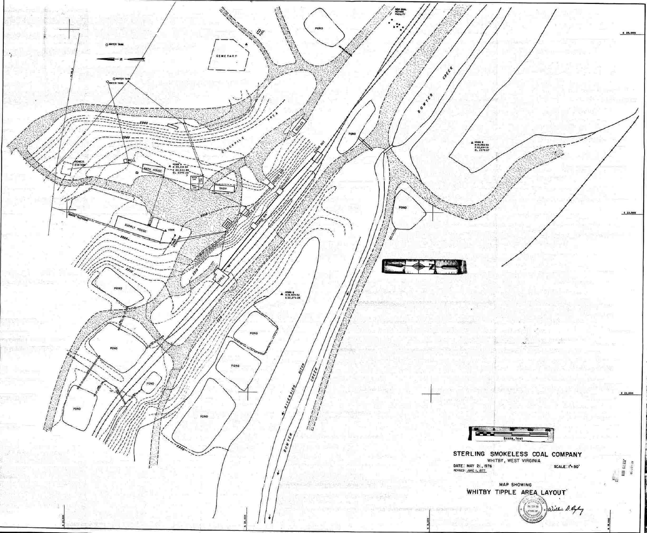
NOTE there is a cemetery just at the hill at the top of this map. According to local historian Bob Duncan, "That is the Halstead Cemetery, located just above the old Whitby Tipple, One acre of land was set aside for a cemetery by Charley Halstead many years ago. As a boy I remember the Cemetery was kept clean. One head stone is marked " Charles Halstead" "born in New York City". Whitby was once part of the 2000+ acres of the Halstead farm." Thanks Bob for this information.
My mother remembers leaving flowers there on some of the graves, but they did not know any of the folks there. Just lonely graves.
I will be getting more educated on mining facilities and their workings as I am still studying this map. Made in 1976, I do not know what structures are still in Whitby versus those like the Tipple that are gone. A table has been provided below with all related Whitby WV Tipple links...
Whitby WV Tipple area Layout Map
|