|
|
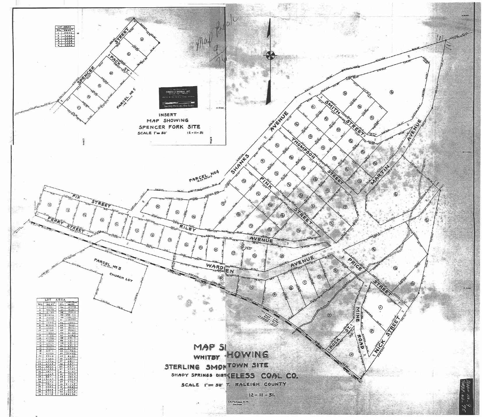
The Streets of Whitby circa 1951. My Grandmother lived on Fink Street.
The following was made possible by the contributions of Nick Thompson, Jack Sisk, Glen Shanks, The Bragg brothers, and the Staffords. Thanks to all of you as there will be many more updates on this page. I know there will be corrections for sure. NOTE: This map represents Whitby AFTER the streets were redug to go through the center of the camp itself. You can see this with Fink, Thompson and Smith Streets in the map below. The streets were redug in the early 50's. So, now we have really another thing to consider when looking at Whitby. If you lived in Whitby prior to the 50's, the sense of direction is radically different that what myself and others know after that time. There were roads between houses that allowed you to walk through the camp. As the roads were redone, much of what folks could recall is gone. A map of this view is now avalable by clicking on the links in the table below. Further updates will be coming...
map below to recreate Whitby. NOTE: There is a link to the tipple area at the bottom of this page.
|
|
| Back to Main Whitby WV Page | 1940's Whitby WV Street Map (Thanks Glen!) | Whitby WV Tipple map page |